In the years we lived in the Denver area, I had a little demonstration I was fond of putting on for visitors. We lived in the Cherry Creek valley, on the southeastern quarter of the metropolitan area; to our southeast ran Smokey Hill road, which (before the recent explosion of development) ran out onto the eastern plains, the high prairie that makes up most of eastern Colorado. There was a pullout on the Smokey Hill at the top of a long, low rise, from which one had a splendid view of the Front Range, dominating the western skyline. And, looking down into the Platte River valley, looking very tiny by comparison, were the skyscrapers of downtown Denver.
Plenty of man's efforts look pretty small set against nature. All you have to do is look at a mountain range, a grand sweep of prairie, the great northern taiga, or what Robert Heinlein called the "ungrokkable vastness of ocean" to realize that. A good volcano will also bring that lesson home, as will an earthquake or a tsunami.
Which brings me to the Cascadia Subduction Zone.
Experts have issued a warning about a potential “mega tsunami” that could sweep away entire communities with its massive waves.
Alaska, Hawaii and the West Coast of the mainland US face an ongoing threat due to how close they are to disaster zones — and the West Coast just received a renewed warning.
A new study published in the Proceedings of the National Academy of Sciences revealed that an earthquake could erupt along the Cascadia subduction zone, a fault that stretches from Northern Vancouver Island to Cape Mendocino, California.
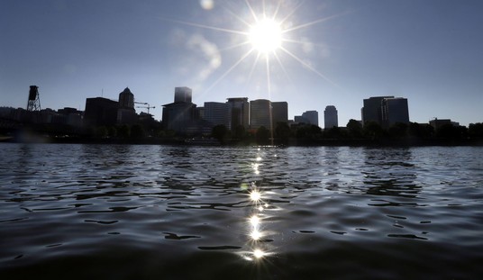
Researchers from Virginia Tech found that a potential powerful earthquake combined with rising sea levels could lead to a mega tsunami, most severely impacting residents and properties in Northern California, northern Oregon and southern Washington.
A mega tsunami is a disastrous wave caused by the displacement of ocean water, which can be triggered by earthquakes, landslides or volcanic eruptions.
Now, as for that warning, there's no reason to panic just yet.
The experts stressed that the fault line has a 15% chance of creating an earthquake with a magnitude 8.0 or greater within the next 50 years, which could cause coastal land to sink up to 6½ feet.
How do we have any idea what the possible effects of such an event might be? Because it's happened before.
This earthquake, one of the largest in the history of North America, was found by combining First Nations and Native American oral histories with tree-ring dating and other geological evidence in North America and an “orphan tsunami” in Japan. The location has been assigned to the approximate center of the Cascadia Subduction Zone, based on the conclusion that an event of this size likely ruptured nearly all this 1,100 km zone.
Note that, aside from the geological evidence, not limited to tree-ring dating, but also evidence such as deep mud layers left by sudden flooding, the researchers rely on the oral histories of the Native tribes in the Cascadia region. However, in Japan, there are quite good records of the "orphan tsunami" in 1700, which caused flooding and damage with no accompanying (in Japan) tremors.
All these bits of data point to a major slip of the Cascadia Subduction Zone in 1700. And, no, climate change can't cause this. Nothing humans can do can cause another such event, or prevent one. Like the Yellowstone caldera, like the possibility of another Everest-sized asteroid crashing into the planet, there isn't a thing we can do about it.
See Also: UN Chief Caught in Lie About Samoa Climate Claim
'Chaos Would Reign': The Alaska Volcano That Could Shut Down the Northern Hemisphere
That doesn't mean there isn't a good reason to understand what's happening in an event like this.
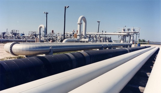
The Cascadia fault is a subduction zone, where the Gorda, Juan de Fuca, and Explorer plates, minor tectonic plates, are being pushed under the larger North American plate. The zone reaches from northern California to Vancouver. The plates being subducted can actually bend the North American plate downward, and when the stress on the larger continental plate grows high enough, that plate can snap back. This can result in an earthquake of up to 9.0 on the Richter scale, and displace a great deal of ocean, resulting in a megatsunami. It could also trigger eruptions of the various volcanoes of the Cascade Volcanic Arc - including Mount St. Helens, Mount Shasta, and Lassen Peak.
A megatsunami alone would have terrible consequences, possibly wiping most of the West Coast off the map: Cities from Anchorage to Los Angeles could be badly damaged or destroyed.
Feeling small yet?
So why worry about this possibility? Well, I wouldn't recommend worrying about something that we can't do anything about. But understanding the physical processes involved, the possible consequences of an event, might help us to better understand any possible warning signs that the pressure on the North American plate is reaching dangerous levels. But what may be of even greater benefit to the general public from work done here is to show the general public what real science looks like, as opposed to the panic-mongering of climate scolds.
There have been and always will be massive events like this. There have been and always will be a changing climate. The key is knowing science from pseudo-science - and knowing which issues are worth researching and understanding, and which are a waste of the taxpayers' money.